Geography is a fascinating field that encompasses the study of the Earth’s landscapes, environments, and the relationships between people and their environments. Understanding key geographic terms is essential for anyone looking to grasp the complexities of this subject, whether you’re a student, teacher, or just an enthusiast. This blog post delves into 50 of the most common English geography terms, providing clear definitions, phonetic transcriptions, and practical examples to illustrate each concept.
50 Essential Geography English Terms Explained with Examples
By mastering these terms, you’ll enhance your ability to discuss geographic phenomena accurately and confidently. Whether you’re preparing for exams, engaging in educational discussions, or simply curious about the world, this guide will serve as a valuable resource for expanding your geographic vocabulary. Dive in to explore and demystify the essential terms that form the foundation of geographic literacy.
#1. Latitude 🌍
Definition: Latitude refers to the distance north or south of the Equator, measured in degrees. It affects climate and weather patterns.
Phonetic Transcription: /ˈlætɪˌtjuːd/
Examples:
- The equator is located at 0° latitude and divides the Earth into the Northern and Southern Hemispheres.
- Cities closer to the poles, such as Oslo, Norway, have higher latitudes and experience colder climates compared to cities near the equator, like Quito, Ecuador.
#2. Longitude 📍
Definition: Longitude is the distance east or west of the Prime Meridian, measured in degrees. It helps determine time zones and global positioning.
Phonetic Transcription: /ˈlɒŋɡɪtjuːd/
Examples:
- The Prime Meridian, set at 0° longitude, runs through Greenwich, England, and serves as the starting point for measuring time zones.
- New York City is located at approximately 74°W longitude, which helps distinguish it from cities on the opposite side of the globe, like Tokyo, which is around 139°E longitude.
#3. Equator 🌐
Definition: The Equator is an imaginary line around the middle of the Earth, equidistant from the North and South Poles, dividing the Earth into the Northern and Southern Hemispheres.
Phonetic Transcription: /ɪˈkwɔːtə(r)/
Examples:
- Countries like Brazil and Indonesia lie on or near the Equator and have tropical climates.
- The Equator experiences equal day and night lengths throughout the year, unlike regions farther from it.
#4. Hemisphere 🌎
Definition: A hemisphere is half of the Earth, divided either by the Equator into Northern and Southern Hemispheres or by the Prime Meridian into Eastern and Western Hemispheres.
Phonetic Transcription: /ˈhɛmɪsfɪər/
Examples:
- Australia is located in the Southern Hemisphere, which experiences winter from June to August.
- The Northern Hemisphere includes countries like Canada and China, which have summer from June to September.
#5. Tropic of Cancer 🌞
Definition: The Tropic of Cancer is the latitude line at approximately 23.5°N of the Equator, marking the northernmost point where the sun can be directly overhead.
Phonetic Transcription: /ˈtrɒpɪk əv ˈkænsər/
Examples:
- The Tropic of Cancer passes through Mexico, and cities like Cancún experience high temperatures and sunny weather.
- The summer solstice occurs when the sun is directly above the Tropic of Cancer, leading to the longest day of the year in the Northern Hemisphere.
#6. Tropic of Capricorn 🌞
Definition: The Tropic of Capricorn is the latitude line at approximately 23.5°S of the Equator, marking the southernmost point where the sun can be directly overhead.
Phonetic Transcription: /ˈtrɒpɪk əv ˈkæprɪkɔːn/
Examples:
- The Tropic of Capricorn passes through Australia, with regions like Queensland experiencing high temperatures during summer.
- The winter solstice happens when the sun is directly above the Tropic of Capricorn, resulting in the shortest day of the year in the Southern Hemisphere.
#7. Prime Meridian 🕰️
Definition: The Prime Meridian is the starting point for measuring longitude, set at 0° longitude, and runs through Greenwich, England.
Phonetic Transcription: /praɪm ˈmɛrɪdiən/
Examples:
- The Prime Meridian divides the Earth into Eastern and Western Hemispheres and is used as a reference for time zones.
- When it is noon at the Prime Meridian, it is 7 AM in New York City, which is in the Eastern Time Zone.
#8. Equinox 🌗
Definition: An equinox occurs when day and night are approximately equal in length, happening twice a year during the spring and autumn equinoxes.
Phonetic Transcription: /ˈiːkwɪnɒks/
Examples:
- The vernal equinox marks the beginning of spring in the Northern Hemisphere and occurs around March 21.
- The autumnal equinox, occurring around September 23, signals the start of fall in the Northern Hemisphere.
#9. Solstice 🌞
Definition: A solstice occurs when the sun is at its highest or lowest point relative to the Equator, resulting in the longest or shortest day of the year.
Phonetic Transcription: /ˈsɒlstɪs/
Examples:
- The summer solstice, around June 21, results in the longest day of the year in the Northern Hemisphere.
- The winter solstice, around December 21, gives the shortest day of the year in the Northern Hemisphere.
#10. Continent 🌍
Definition: A continent is a large continuous mass of land, typically distinguished by geographic and cultural boundaries. There are seven continents on Earth.
Phonetic Transcription: /ˈkɒntɪnənt/
Examples:
- Asia is the largest continent by both area and population, home to diverse cultures and landscapes.
- Antarctica, covered in ice, is the least populated continent and is primarily known for its scientific research stations.
#11. Ocean 🌊
Definition: An ocean is a vast body of saltwater that covers most of the Earth’s surface, divided into five major oceans: Pacific, Atlantic, Indian, Southern, and Arctic.
Phonetic Transcription: /ˈəʊʃən/
Examples:
- The Pacific Ocean is the largest and deepest ocean, covering more than 63 million square miles.
- The Atlantic Ocean separates the Americas from Europe and Africa and is known for its role in maritime exploration.
#12. Island 🏝️
Definition: An island is a landmass completely surrounded by water, varying greatly in size from small islets to large landmasses like Greenland.
Phonetic Transcription: /ˈaɪlənd/
Examples:
- Madagascar is the fourth largest island in the world and is known for its unique biodiversity.
- Bora Bora, a small island in French Polynesia, is famous for its stunning beaches and luxury resorts.
#13. Archipelago 🏝️
Definition: An archipelago is a group or chain of islands clustered together in a sea or ocean.
Phonetic Transcription: /ˌɑːrkɪˈpɛləɡoʊ/
Examples:
- The Indonesian Archipelago consists of over 17,000 islands, including Bali and Sumatra.
- The Aegean Archipelago includes numerous islands in the Aegean Sea, such as Crete and Rhodes.
#14. Peninsula 🏞️
Definition: A peninsula is a landform that extends into a body of water, connected to the mainland on one side.
Phonetic Transcription: /pəˈnɪnsjələ/
Examples:
- The Iberian Peninsula includes Spain and Portugal and is bordered by the Atlantic Ocean and Mediterranean Sea.
- The Florida Peninsula is surrounded by the Gulf of Mexico and the Atlantic Ocean.
#15. Plateau ⛰️
Definition: A plateau is a flat-topped area of elevated land, often resulting from geological activity.
Phonetic Transcription: /plæˈtəʊ/
Examples:
- The Colorado Plateau in the USA features dramatic landscapes and is home to the Grand Canyon.
- The Deccan Plateau in India is a large area of highland that covers much of southern India.
#16. Valley 🌄
Definition: A valley is a low area between hills or mountains, typically with a river or stream running through it.
Phonetic Transcription: /ˈvæli/
Examples:
- The Yosemite Valley in California is renowned for its stunning granite cliffs and waterfalls.
- The Nile Valley in Egypt has been a center of ancient civilization due to its fertile land.
#17. River 🌊
Definition: A river is a natural watercourse that flows towards an ocean, sea, or lake, often providing essential resources for surrounding regions.
Phonetic Transcription: /ˈrɪvə(r)/
Examples:
- The Amazon River in South America is the largest river by volume and runs through the Amazon Rainforest.
- The Nile River is one of the longest rivers in the world, flowing through northeastern Africa.
#18. Delta 🌊
Definition: A delta is a landform where a river meets a body of water and deposits sediment, forming a typically triangular or fan-shaped area.
Phonetic Transcription: /ˈdɛltə/
Examples:
- The Mississippi Delta is known for its rich alluvial soil and is crucial for agriculture in the region.
- The Nile Delta is one of the most fertile areas in Egypt and has been a key agricultural zone for millennia.
#19. Estuary 🌊
Definition: An estuary is a coastal area where freshwater from rivers meets and mixes with saltwater from the ocean.
Phonetic Transcription: /ˈɛstjʊəri/
Examples:
- The Thames Estuary in the UK is an important location for shipping and wildlife.
- The San Francisco Bay Estuary provides critical habitat for various fish and bird species.
#20. Glacier 🏔️
Definition: A glacier is a large mass of ice that moves slowly over land, forming through the accumulation and compaction of snow.
Phonetic Transcription: /ˈɡleɪʃər/
Examples:
- The Greenland Ice Sheet is a massive glacier covering most of Greenland.
- The Glacier National Park in Montana is known for its stunning glaciers and diverse ecosystems.
#21. Iceberg 🧊
Definition: An iceberg is a large piece of freshwater ice that has broken off from a glacier and floats in the ocean.
Phonetic Transcription: /ˈaɪsbɜːɡ/
Examples:
- The Titanic famously struck an iceberg in the North Atlantic Ocean, leading to its sinking.
- Icebergs are commonly found in the waters around Antarctica and Greenland.
#22. Desert 🌵
Definition: A desert is a barren area with very little precipitation, often characterized by extreme temperatures and sparse vegetation.
Phonetic Transcription: /ˈdɛzərt/
Examples:
- The Sahara Desert in Africa is the largest hot desert in the world, known for its vast sand dunes.
- The Atacama Desert in Chile is one of the driest places on Earth, with some areas receiving no rainfall for years.
#23. Rainforest 🌳
Definition: A rainforest is a dense forest with high annual rainfall, typically found in tropical regions.
Phonetic Transcription: /ˈreɪnˌfɔːrɪst/
Examples:
- The Amazon Rainforest in South America is the largest tropical rainforest and is crucial for global biodiversity.
- The Congo Rainforest in Africa is known for its rich wildlife and is one of the world’s oldest rainforests.
#24. Savanna 🌿
Definition: A savanna is a grassy plain with few trees, found in tropical and subtropical regions with a seasonal rainfall pattern.
Phonetic Transcription: /səˈvænə/
Examples:
- The Serengeti in Tanzania is a famous savanna known for its wildlife migrations.
- The Brazilian Cerrado is a large savanna region with unique plant and animal species.
#25. Steppe 🌾
Definition: A steppe is a large, grassy plain without trees, found in regions with moderate rainfall and distinct seasonal temperature changes.
Phonetic Transcription: /stɛp/
Examples:
- The Eurasian Steppe stretches from Eastern Europe to Mongolia and is known for its vast grasslands.
- The North American Great Plains are a steppe region characterized by their flat terrain and agricultural productivity.
#26. Tundra ❄️
Definition: Tundra is a cold, treeless biome found in polar regions and high mountain tops, with short growing seasons and permafrost.
Phonetic Transcription: /ˈtʌndrə/
Examples:
- The Arctic Tundra is found in the northernmost parts of Canada and Russia, with low temperatures and limited vegetation.
- The Alpine Tundra is located on high mountain tops, such as the Rocky Mountains in North America.
#27. Marsh 🌿
Definition: A marsh is a wetland area with soft, waterlogged soil and vegetation like grasses and reeds.
Phonetic Transcription: /mɑːrʃ/
Examples:
- The Everglades in Florida are a large marsh ecosystem known for its unique wildlife and plant species.
- The Pantanal in Brazil is the world’s largest tropical wetland, featuring extensive marshlands and rich biodiversity.
#28. Bog 🌾
Definition: A bog is a wetland area characterized by acidic, waterlogged conditions and a buildup of peat.
Phonetic Transcription: /bɒɡ/
Examples:
- The Sphagnum moss bogs in Ireland are known for their distinctive plant species and historical significance.
- The Bogs of the Scottish Highlands provide important habitats for various bird species and support unique vegetation.
#29. Swamp 🌳
Definition: A swamp is a wetland with standing water and abundant vegetation, often with trees and shrubs.
Phonetic Transcription: /swɒmp/
Examples:
- The Florida Swamp is part of the Everglades and supports a diverse range of wildlife, including alligators.
- The Okavango Delta in Botswana is a large inland delta known for its swampy terrain and rich animal life.
#30. Canyon 🏞️
Definition: A canyon is a deep, narrow valley with steep sides, often carved by a river over millions of years.
Phonetic Transcription: /ˈkæn.jən/
Examples:
- The Grand Canyon in Arizona is one of the most famous canyons, renowned for its stunning geological formations.
- The Colca Canyon in Peru is one of the deepest canyons in the world and is known for its dramatic scenery.
#31. Gorge 🏞️
Definition: A gorge is a narrow valley between hills or mountains, often formed by the erosion of a river.
Phonetic Transcription: /ɡɔːrdʒ/
Examples:
- The Samaria Gorge in Crete is a popular hiking destination known for its rugged beauty.
- The Columbia River Gorge stretches between Washington and Oregon and is renowned for its spectacular landscapes.
#32. Basin 🌊
Definition: A basin is a large, low-lying area where water collects, often leading to the formation of lakes or river systems.
Phonetic Transcription: /ˈbeɪsən/
Examples:
- The Amazon Basin is a vast area in South America where the Amazon River and its tributaries flow.
- The Great Basin in the western United States is an arid region with numerous salt flats and lakes.
#33. Bay 🌊
Definition: A bay is a broad inlet of the sea where the land curves inward, often providing sheltered waters.
Phonetic Transcription: /beɪ/
Examples:
- The San Francisco Bay is a large bay on the west coast of the United States, known for its iconic Golden Gate Bridge.
- The Bay of Bengal is a large bay in the northeastern part of the Indian Ocean, bordered by India, Bangladesh, and Myanmar.
#34. Sea 🌊
Definition: A sea is a large body of saltwater that is smaller than an ocean and is partially enclosed by land.
Phonetic Transcription: /siː/
Examples:
- The Mediterranean Sea is a major sea connected to the Atlantic Ocean and bordered by Europe, Africa, and Asia.
- The Dead Sea is a salt lake bordered by Jordan to the east and Israel and Palestine to the west, known for its high salinity.
#35. Coastline 🌊
Definition: The coastline is the area where land meets the sea, characterized by features such as beaches, cliffs, and bays.
Phonetic Transcription: /ˈkəʊstlaɪn/
Examples:
- The Great Ocean Road in Australia offers stunning views of the rugged coastline and natural rock formations.
- The Amalfi Coast in Italy is famous for its picturesque coastal scenery and charming seaside villages.
#36. Shoreline 🌊
Definition: The shoreline is the line where land meets the water, often used to describe the edge of a body of water.
Phonetic Transcription: /ˈʃɔːrlaɪn/
Examples:
- The shores of Lake Michigan offer recreational opportunities and scenic views in the U.S. Midwest.
- The shoreline of the Hawaiian Islands is known for its beautiful beaches and volcanic formations.
#37. Fjord 🌊
Definition: A fjord is a deep, narrow sea inlet bordered by steep cliffs or slopes, typically formed by glacial activity.
Phonetic Transcription: /fjɔːrd/
Examples:
- The Geirangerfjord in Norway is renowned for its dramatic scenery and is a popular destination for cruises.
- The Milford Sound in New Zealand is a famous fjord known for its breathtaking natural beauty.
#38. Ridge ⛰️
Definition: A ridge is a long, narrow elevated landform, often the crest of a mountain range or a high hill.
Phonetic Transcription: /rɪdʒ/
Examples:
- The Appalachian Ridge in the eastern United States features a series of rugged hills and mountains.
- The Andes Ridge stretches along the western coast of South America, forming one of the longest mountain ranges in the world.
#39. Moraine ⛰️
Definition: A moraine is an accumulation of glacial debris, such as rocks and soil, deposited by a glacier.
Phonetic Transcription: /mɔːˈreɪn/
Examples:
- The terminal moraine in the Finger Lakes region of New York marks the furthest advance of a glacier.
- Moraine Lake in Canada is known for its stunning turquoise waters and surrounding moraine deposits.
#40. Butte ⛰️
Definition: A butte is a steep, isolated hill with a flat top, often found in arid or semi-arid regions.
Phonetic Transcription: /bjuːt/
Examples:
- Monument Valley in Arizona features several iconic buttes, including the famous “Totem Pole.”
- The Painted Desert in Arizona includes numerous buttes with striking colorations.
#41. Mesa ⛰️
Definition: A mesa is an isolated flat-topped hill with steep sides, commonly found in arid regions.
Phonetic Transcription: /ˈmeɪsə/
Examples:
- Mesa Verde in Colorado is known for its ancient cliff dwellings and mesa formations.
- The Grand Mesa in Colorado is one of the largest flat-topped mesas in the world.
#42. Basin and Range ⛰️
Definition: The Basin and Range is a geographic region characterized by alternating mountain ranges and desert basins.
Phonetic Transcription: /ˈbeɪsən ənd reɪndʒ/
Examples:
- The Great Basin in the western United States is a prominent example of the Basin and Range region.
- The Nevada desert features numerous mountain ranges and basins typical of the Basin and Range topography.
#43. Sedimentary Rock 🪨
Definition: Sedimentary rock is formed from the accumulation and compression of sediments, such as sand, mud, and pebbles.
Phonetic Transcription: /ˌsɛdɪˈmɛntri rɒk/
Examples:
- Sandstone is a common sedimentary rock formed from sand grains cemented together.
- Limestone, often found in cave formations, is another type of sedimentary rock formed from calcium carbonate.
#44. Igneous Rock 🪨
Definition: Igneous rock forms from the cooling and solidification of molten magma or lava.
Phonetic Transcription: /ˈɪɡniəs rɒk/
Examples:
- Granite is an igneous rock that forms from magma cooling slowly underground.
- Basalt is a common igneous rock formed from lava cooling rapidly on the Earth’s surface.
#45. Metamorphic Rock 🪨
Definition: Metamorphic rock is created from existing rocks that have undergone transformation due to heat, pressure, or chemical processes.
Phonetic Transcription: /ˌmɛtəˈmɔːrfɪk rɒk/
Examples:
- Marble is a metamorphic rock formed from limestone subjected to heat and pressure.
- Schist is a type of metamorphic rock known for its foliated texture and mineral composition.
#46. Erosion 🌧️
Definition: Erosion is the process by which natural forces, such as wind, water, or ice, wear away and transport soil and rock.
Phonetic Transcription: /ɪˈrəʊʒən/
Examples:
- Coastal erosion can lead to the loss of beaches and cliffs due to the action of waves and tides.
- River erosion can create canyons and valleys as flowing water removes sediment from the landscape.
#47. Sediment 🌊
Definition: Sediment refers to particles of rock, soil, and organic material that are transported and deposited by wind, water, or ice.
Phonetic Transcription: /ˈsɛdɪmənt/
Examples:
- River sediment often settles at the river’s mouth, forming deltas and affecting water quality.
- Beach sediment includes sand, shells, and other materials deposited by ocean waves.
#48. Fault Line 🌍
Definition: A fault line is a fracture in the Earth’s crust where blocks of rock have moved relative to each other.
Phonetic Transcription: /fɔːlt laɪn/
Examples:
- The San Andreas Fault in California is a major fault line known for frequent earthquakes.
- The North Anatolian Fault in Turkey is another significant fault line with a history of seismic activity.
#49. Volcano 🌋
Definition: A volcano is an opening in the Earth’s crust through which molten lava, ash, and gases erupt.
Phonetic Transcription: /vɒlˈkeɪnoʊ/
Examples:
- Mount Vesuvius in Italy famously erupted in AD 79, burying the city of Pompeii under ash.
- Mount Fuji in Japan is an iconic stratovolcano known for its symmetrical cone shape.
#50. Earthquake 🌍
Definition: An earthquake is the shaking of the Earth’s surface caused by the sudden release of energy from the Earth’s crust.
Phonetic Transcription: /ˈɜːrθkweɪk/
Examples:
- The 2010 Haiti earthquake was a devastating seismic event that caused significant damage and loss of life.
- The 2011 Tōhoku earthquake in Japan triggered a tsunami and led to a major nuclear crisis at Fukushima.
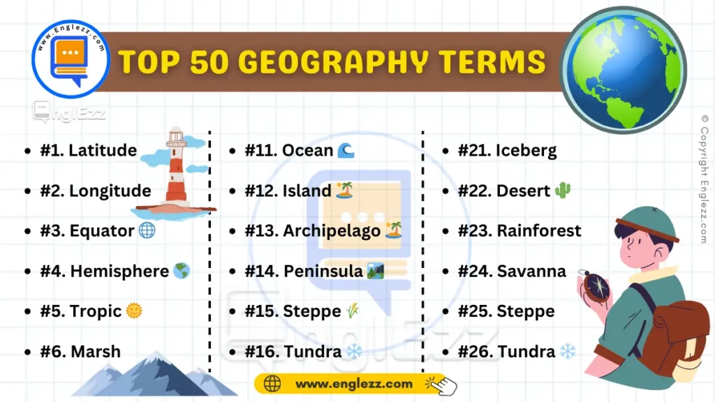
Geography English Terms Table
| #1. Latitude 🌍 | #11. Ocean 🌊 | #21. Iceberg 🧊 |
| #2. Longitude 📍 | #12. Island 🏝️ | #22. Desert 🌵 |
| #3. Equator 🌐 | #13. Archipelago 🏝️ | #23. Rainforest 🌳 |
| #4. Hemisphere 🌎 | #14. Peninsula 🏞️ | #24. Savanna 🌿 |
| #5. Tropic of Cancer 🌞 | #15. Steppe 🌾 | #25. Steppe 🌾 |
| #6. Tropic of Capricorn 🌞 | #16. Tundra ❄️ | #26. Tundra ❄️ |
| #7. Prime Meridian 🕰️ | #17. River 🌊 | #27. Marsh 🌿 |
| #8. Equinox 🌗 | #18. Delta 🌊 | #28. Bog 🌾 |
| #9. Solstice 🌞 | #19. Estuary 🌊 | #29. Swamp 🌳 |
| #10. Continent 🌍 | #20. Glacier 🏔️ | #30. Canyon 🏞️ |
Conclusion
Understanding common geography terms can significantly enhance your grasp of the world’s physical features and environmental processes. From the intricacies of landforms like mesas and canyons to the dynamic elements of earthquakes and volcanoes, these terms offer insight into the diverse and interconnected nature of our planet.
Mastering this vocabulary not only aids in academic endeavors but also enriches everyday conversations about our environment.
Whether you’re exploring new places, studying for exams, or simply satisfying your curiosity about the Earth, this guide serves as a comprehensive resource.
By familiarizing yourself with these essential terms, you’re better equipped to appreciate the complexities of geography and contribute meaningfully to discussions about our world.





Unlock the secrets of geography with our latest guide on the “50 Most Common Geography English Terms Explained with Examples”! 🌍 Dive deep into essential terms and enhance your understanding of the Earth’s wonders. For more engaging content, follow and like us @EnglEzz! 🌟
Check out the full post here:
https://www.englezz.com/essential-geography-english-terms/
.
.
#englezz #vocabulary #linguistics #geography #education #learnenglish #earthscience #explore #study